
Hybrid airships: a scalable, sustainable solution for remote cargo logistics

With its unique capabilities, including the patented Air Cushion Landing System that allows it to land almost anywhere, the Z1 is a true Swiss Army knife of aviation, ideal for a vast range of applications, especially in remote regions of the world where traditional infrastructure is expensive or impossible.
Billions of people lack access to reliable transport, often living in precious ecosystems like the Arctic, where building infrastructure is both unimaginably expensive and environmentally irresponsible. That’s where our hybrid airships change the game – offering sustainable, low-impact mobility with applications across industries and humanitarian sectors. In doing so, we support the delivery of 17 of the 19 United Nations Sustainable Development Goals.

Cargo & Freight
Hybrid airships can transport goods, equipment and materials to remote regions of the world.
Deliver significant cost savings in airport, road and rail construction, especially for remote oil, gas and mining projects.
Enable wind and solar energy projects in isolated areas by delivering turbine parts and installation equipment.
Transport fresh produce, fuel, oil and water to and from remote communities, stimulating local economies by delivering their products to market.
Offer direct, point-to-point logistics that reduce intermodal handling and associated costs.
Outperform heavy-lift helicopters in lift capacity, range and operational cost.
Read more about our remote connectivity capabilities.

Humanitarian Aid
Billions of people around the world live without access to reliable infrastructure, leading to poor medical, economic, nutritional and educational outcomes.
Often these remote communities are found in precious ecosystems such as the Amazon or the Arctic, where building roads or airports is not only economically unfeasible but environmentally unthinkable.
Our hybrid airships can use their land-anywhere capability to deliver supplies, mobile hospitals, clean water, food and staff - supporting remote communities without damaging the environment.
Read more about how our hybrid airships are transforming remote logistics and read more about how we can solve the cold chain crisis.

Disaster Relief
Land-anywhere capability is ideal for accessing disaster zones where roads, airports, seaports and communications are down.
Our hybrid airships provide medevac services and can be configured as ‘flying hospitals’ with power and surgical facilities.
Deliver rescue teams, generators, vehicles, equipment, food and water – while evacuating victims on return trips.
Maintain critical supply chains when traditional logistics are disrupted, ensuring continuous delivery of supplies during the most critical hours and days following a disaster.
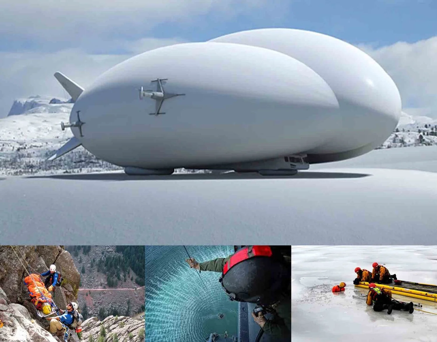
Search and Rescue
Our advanced hybrid airships reach remote and oceanic search and rescue areas faster than surface ships.
Hover and operate at low speeds for extended periods: ideal for searching large or difficult terrains.
Land on almost surface without needing infrastructure and deploy ancillary vehicles to recover survivors and assist with clean up.
Able to equip with powerful sensors and other equipment to assist search efforts over a wide area.

Mobile Command and Control Centre
Support crisis monitoring and rapid deployment for law enforcement, military, event management and other organisations needing high quality, mobile video surveillance.
Deploy close to conflict, flashpoint or surveillance zones, regardless of infrastructure, for optimal situational command and control.
Equip with sensors, monitoring systems, remote transmission and command applications.
Can deploy on land or utilise the hybrid airship’s ability to loiter in flight close to the flashpoint for extended periods.
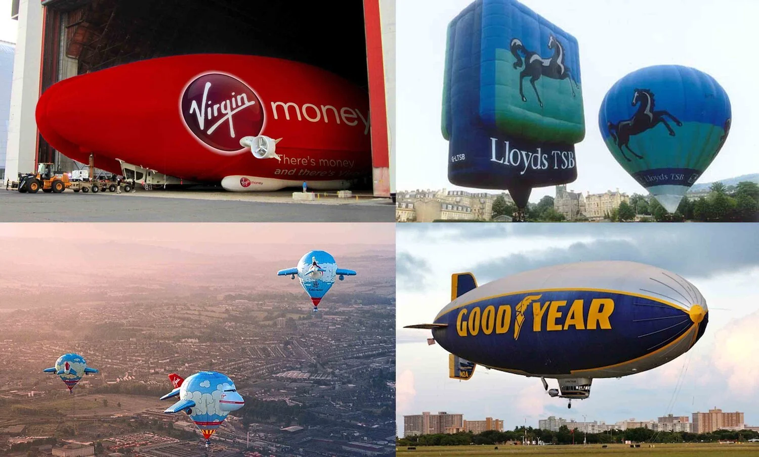
Advertising & Promotion
Act as massive flying billboards for brand promotion and ancillary revenue generation.
Provide added promotional value during cargo or other operations.
Impact can be enhanced with additional features such as large, interactive LED signs, AR and gamified experiences, competitions and giveaways and influenced-based content creation. The branded airship can form the backdrop of VIP hangar events and receptions.
Straightline Aviation built the world’s largest and most successful commercial airship advertising fleet in history.

Telecommunications
Quickly re-establish vital telecoms networks in disaster zones using wireless transport devices mounted to the hybrid airship.
Enable immediate communication for emergency responders during critical early disaster response.
Allow government and relief agencies to coordinate search and rescue response and locate injured or trapped victims efficiently.
Provide essential phone service when cellular networks are down, speeding up organized rescue efforts.
Swiftly establish stable communications, to enable first responders to prevent further loss of life or damage to property.

Aerial Surveillance & Border Control
Long-duration surveillance flights (1400 nautical mile range) with lower fuel use and noise than conventional aircraft.
Provides a stable, mobile multi-sensor platform for far ranging, endurance border patrols.
Support border and coast guard agencies with rescue and patrol capabilities, and can be used as a platform for ancillary vehicles.
Enable intelligence gathering, airspace surveillance, infrastructure monitoring, fishery protection and undersea cable protection.
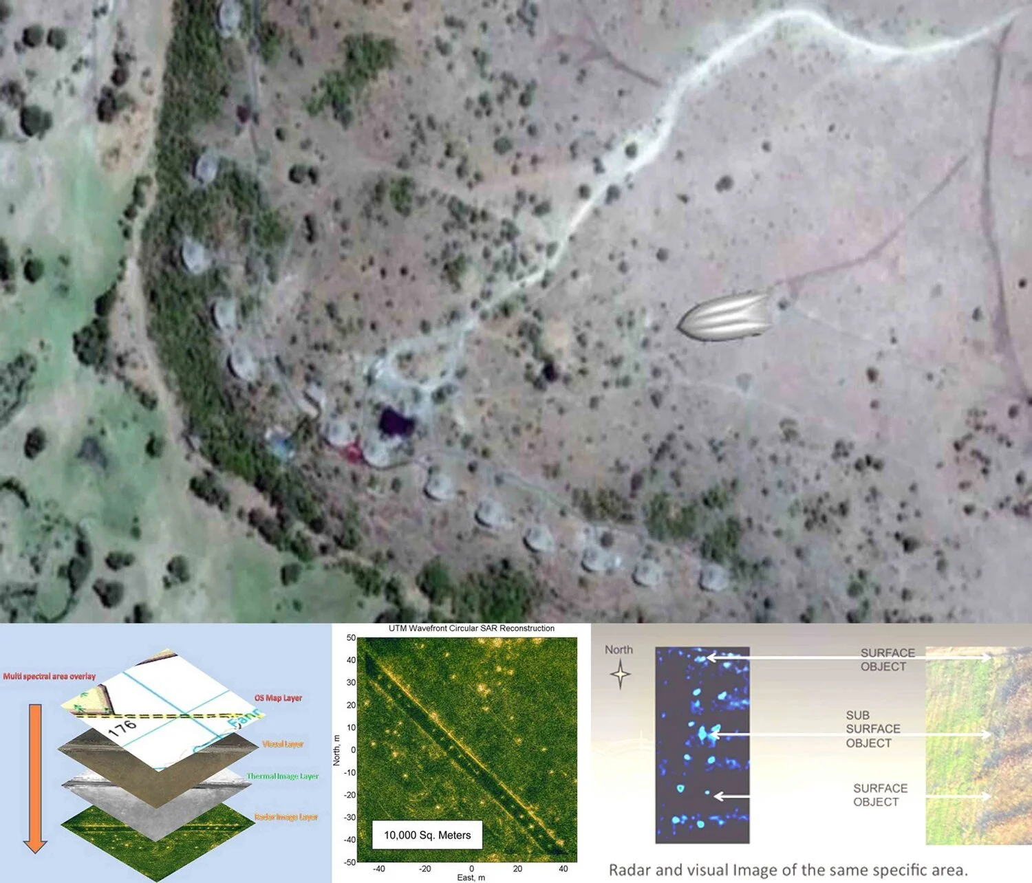
Reconnaissance (ISR), Scientific Survey & Mapping
Perform ISR to support intelligence, planning and decision-making.
Hybrid airships offer aerial survey capabilities for environmental, construction, humanitarian and utility sectors.
Our team has significant experience with landmine detection and removal via advanced airborne technology (MIR™).
Conduct 3D virtual modelling, thermal imaging, oil spill monitoring and surveys of infrastructure such as oil pipelines and cable routes.
Generate high definition 3D imagery for to inform strategic land use, transport planning and mineral extraction decisions.
Leverage improved GPSAR and data processing for automated mapping of unexploded ordnance and topographical features.